

Clearing distances from GPS.
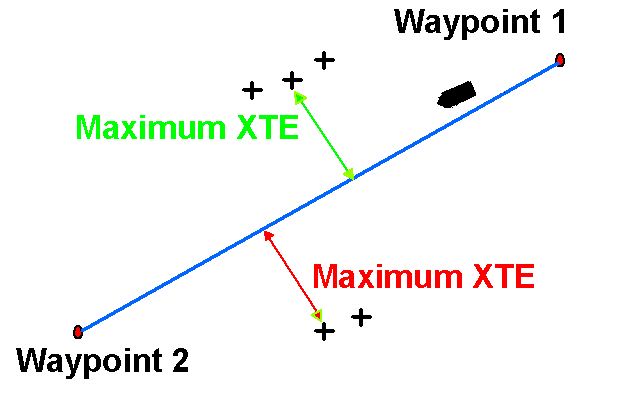
If you have programmed a route in to your GPS navigator you can use the cross track error function to give you clearing distances from the rumb line between two waypoints.
If you plot the track between the two waypoints on the chart. Then measure off the safe distance to any hazards on either side of the track, you can easily stay in safe water by maintaining a cross track error (XTE) of less than this safe distance.
This technique is especially valuable when travelling at high speed as it can be pre-plotted.
Sailtrain.co.uk is free to use, but if you feel you would like to contribute to the running and development costs you can donate via Paypal:
