

Navigation and Chart work - Predicted Estimated Positions
Predicted Estimated Positions
When we create a normal EP the information use is based on what has happened. We take the course steered and distances run from the ships log book. These should be the best estimate of what we think happened on that leg of the passage.
<However, sometimes we want to be able to predict where the vessel is likely to be at some point in the future or the time we are likely to arrive.
Although GPS is good at telling us where we are, it is not so good for making predictions.
Examples of when we may need to predict our position is when we are approaching a traffic separation scheme or an area of hazards that the borders of are not clearly marked.
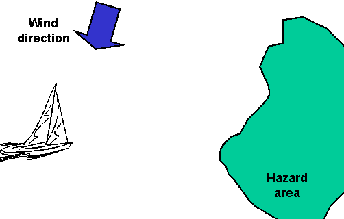
When there is a strong tide running it is not obvious where the vessel will reach the limits of safe water.
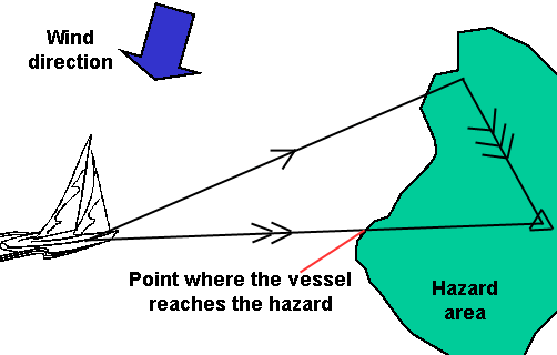
From this it can easily be seen that the vessel will reach the danger zone is a completely different area than might be expected.
If we draw a line parallel to the tidal vector from the point where the ground track crosses the edge of the hazard area, and back towards the water track we can use this to deduce more information.
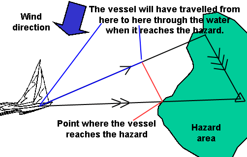
It is now easy to see how much the log will show the vessel has travelled when it reaches the hazard, hopefully the course will be changed in plenty of time!
By comparing this distance with the predicted speed we can also decide the time we need to turn as well and the logged distance.
Obviously this technique is based on predicted information. If the vessel's speed changes or the course is altered this picture could change radically. As will all navigation processes, the navigator needs to keep monitoring what is happening so that any critical changes are identified.
Question 1. Chart 3. Variation = 7°W
If at 07.00, the bearing and distance to a waypoint at the centre of the compass rose to the west of Slade Island is 190°T 4.1M. Plot the vessel's position.
From this position plot the following predicted EP at 08.00. The course is expected to be 070°M and speed 5.8Kn.
Tide is 292°T at 2.5Kn.
A) What is the latitude and longitude of the point where the vessel reaches the traffic separation scheme?
B) How far will the vessel have travelled by the log when it reaches the TSS?
Additional Resources: